
~ Current Schedule ~
How scheduling works:
 One of the Canes, who will be the "leader" of the outing, decides he or she will hike or paddle or bike or ski and works with our Outings Coordinator to describe the outing, which then is posted on this web page. The posting constitutes an invitation to other Canes to join in the outing, subject to two essential conditions: that by joining in the outing a participant represents he or she is physically fit for the particular outing and accepts all risks inherent in the outing activities including risk of injury. New participants are requested to fill out an Acknowledgement of Risk Agreement and submit it to the outing's leader but accepts all risks whether this Agreement is submitted or not. A leader is not a professional guide but merely the volunteer Cane who has invited other Canes to join in the outing. Adverse weather may result in cancellation or postponement; check the schedule for updates.
Practices and traditions: Our traditions go back 45 years. Advance signup is not required. However, prior to attending your first outing, read the information on our Practices and Acknowledgement of Risk pages. Download and sign the Acknowledgement of Risk Agreement form and submit it to the leader of your first Canes outing. At the end of this Schedule is information that may be useful regarding meeting places, outing types, difficulty and useful links.
Today is ,

Refresh the page in your browser to assure you see the latest content.
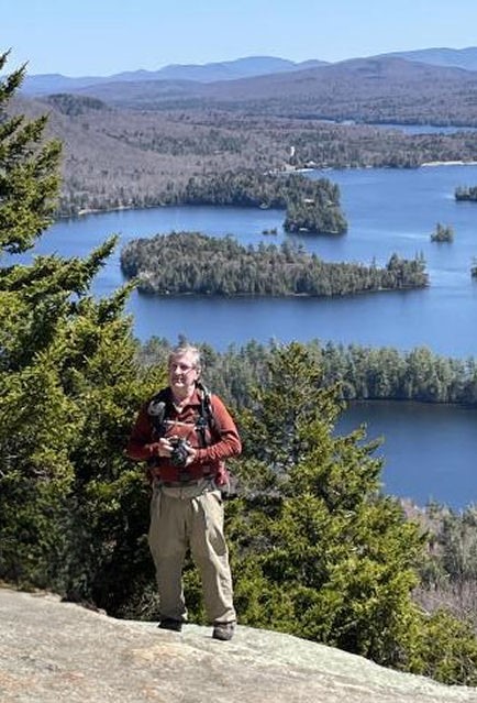
Scheduled outings: Canes enjoy a variety of outings. Easy-rated hikes are generally listed as ALT to allow for a more strenuous Regular outing on the same date. Bonus outings on other days are also encouraged. If you would like to volunteer to lead an outing please contact Leo Demers, Outings Coordinator. Moderate hike ideas for warm days? Stay hydrated and catch the westerly breeze on the mountains on the east side of Lake George: Black, Erebus and/or Fishbrook Pond, Sleeping Beauty, Buck from Shelving Rock Rd, Pilot Knob Ridge.
Jun 25, 2026 Regular Trails of the Corinth Cooperator Area Hike Rating: Moderate Leo Demers 518-654-8042 Email leader WX
The Corinth Cooperator Area (aka Corinth Reservoir Recreation Area) is the watershed for the Village of Corinth and offers a variety of lengths in hikes with combinations that would allow you to hike perhaps 9 miles if desired. I am offering a hike of about 5 miles in length with a total gain of about 1200 ft that will include visits to some popular destinations, such as the Wilson Farm Historic Site, Redmond's Overlook, and Wilson Pass. Along our route we will pass some impressive Old Growth white pines. We will have our lunch at Redmond's Overlook, with expansive views to the east. The trailhead is located on CR 10 (aka Mosher Rd and West Mountain Rd) about 1.5 mi. due west of the Village as the crow flies.
Meet at the CCA trailhead at 9:45; hike begins at 10:00. Directions to the trailhead/parking: For those arriving from the S take Rt 9N N from the Saratoga Springs area and turn left on CR 10 (a short distance N of the Corinth Veterinary Clinic); remain on CR 10 for ~1.75 mi. to the TH on left. For those arriving from the N or E: from the Stewart's Shop at the corner of Main St and Maple Ave (both Rt 9N) continue S for a short distance and turn R on Hamilton St. (White's Ace Hardware on right); continue on Hamilton St. for ~1.25 mi and turn right on CR 10; continue on CR 10 for ~.35 mi to TH on left. Please contact me with any questions.
Jul 2, 2026 No outing yet scheduled
Jul 9, 2026 No outing yet scheduled
Jul 16, 2026 No outing yet scheduled
Jul 23, 2026 Regular Sandgate Vt Bike Ride Rating: Moderate Francoise Herve & Shelly Nevard Email Fran Email Shelly WX
This is an 18-mile bike ride beginning on NY Rt 313 in Shushan and continuing in a clockwise loop through rural valleys and hills of Washington County NY and Vt, some quite remote, to the scenic hamlet of Sandgate Vt, where we will have lunch on a hill at the cemetery. The route continues, mostly down a fairly steep hill, returning to Rt 313, crossing the Arlington Covered Bridge to East River Rd, then back to SR 313 and to our start in NY. Approximately half the route is on hard-packed dirt roads. While the route can be pedaled with a touring/narrow-wheeled bike, a hybrid might be more appropriate. There are some hills, with a gradual elevation gain of approx. 700', then a long, well-earned downhill to Sandgate.
Meet at McDonald's, 1249 Rt 29 in Greenwich, at 9:15 for a 9:30 departure, or at the NY 313 parking area near the NY-Vt border at 10:00ish. The parking area is on the right, 0.7mi past the NY Rt 313 bridge over the Battenkill and is prominently marked by a blue parking area sign. It is called "Stateline Roadside Park, Shushan" on Google Maps (though no restrooms). If you have any questions contact Fran or Shelly.
Jul 30, 2026 No outing yet scheduled
Aug 6, 2026 No outing yet scheduled
Aug 13, 2026 No outing yet scheduled
Aug 18, 2026 Tue Celebration of Karen Burke's Life
Karen was a member of the Crooked Canes for many years. She introduced her Monday hikers to some of her Canes friends, including Peter Fedorick, who led several of her hikes. Karen passed away at Albany Medical Center on May 10th. Following is info from her Monday hiking group about a Celebration of Karen's life.
Please join us in an informal celebration of the life of Karen Burke. Karen led our Monday hikes for more than a decade. She left us a beautiful legacy of lasting memories and lasting friendships. WHERE: Northampton Beach Campsite, 328 Houseman Street, Mayfield WHEN: Tuesday, August 18, 10 AM - ? Bring a dish: hot dogs, hamburgers, sausages, charcuterie, salad, dessert-- to share and your own choice of drink. Wood or charcoal. Bring a place setting. The campsite has a pavillon, picnic tables, and fireplaces. Bring a folding chair. ALSO: bring a written memory of Karen for a “memory jar” that we’ll give to Karen’s family. You are welcome to share your memory with us. KINDLY REPLY to Nolan Marciniec by Tuesday, August 4. Email nolanm29@icloud.com or phone/text 518-775-0211.
Aug 20, 2026 No outing yet scheduled
Aug 27, 2026 No outing yet scheduled
Meeting place: Carol Thomas Lane "CTL" unless specified otherwise in the outing description. More info on CTL, meeting places and times.
Outing types: Outing types are listed as Regular, Alternate (ALT) or Bonus. More info on outing types.
Difficulty: Outing difficulty ratings are shown as "Easy," "Moderate," "Difficult", or a hybrid. These are subjective ratings, and even an "Easy" outing will require attendees to be fit and aware of their physical limitations. More details about difficulty are typically shown in the outing description. Distance and elevation gain shown are generally derived from GPS readings, which are approximate. More info about ratings.
Lead an outing: If you would like to volunteer to lead an outing, please contact an Outings Coordinator. Here's a more detailed information guide. The earlier you respond, the more time your fellow Canes will have to plan to attend your outing.
Air quality, ticks, hunting season, interactive map, and other info: Wild fires in Canada and the western US can cause hazy skies and may also affect ground-level air quality. Check regional air quality for today and links to other useful info.
Seeking a Co-Coordinator: Leo Demers, our Outings Coordinator, is seeking a Co-Coordinator to share the responsibilities, which involve coordinating outings with leaders. This is an opportunity for a Cane to give something back to the Crooked Canes and assure we continue to thrive. Contact Leo to volunteer and/or ask questions.